

How do passenger jets navigate across the globe?
Commercial airliners navigate with pinpoint accuracy using a number of references such GPS, Radio Aids and an onboard Inertial Reference Systems. The systems are of varying accuracy levels, with GPS being the most accurate method (a bit like the Sat Nav in your car) but there are a number of other systems such as an internal navigation system which doesn’t use any external reference as well as some radio beacon receivers which are used for particular phases of flight such as the departure or arrival and approach segments.
These navigation systems consist of:
- Global Positioning System (GPS)
- Inertial Reference Systems (IRS)
- Radio Aids (VORs, DMEs, ADFs, ILSs)
At the start of the flight, the pilots load a predetermined route into the Flight Management System or Computer (FMS / FMC). This imposes the route of the flight onto a moving map which the pilots can monitor on their screens throughout the flight. The pilots can see other things around their flight path on their screens, like other airports, other aircraft, high terrain and bad weather.
The aircraft can detected where it is when compared to the predetermined route through the following navigation systems:
GPS – Global Positioning System
This is one of the primary navigation sources and the aircraft is continuously attempting to monitor its GPS position. This is also typically the most accurate navigation system on most modern commercial aircraft, in some circumstances allowing the aircraft to perform manoeuvres down to an accuracy of 0.1 Nautical Miles.
However, due to its reliability, it can only be used for primary navigation during certain segments of the flight. To use GPS as the primary navigation reference for the Departure (Standard Instrument Departure or SID), or Arrival (Standard Terminal Arrival or STAR) or Approach (RNAV or RNP/GPS/GNSS Approach) specific approval for both the aircraft and airline is required.
GPS is susceptible to a number of limitations. First of all, there are GPS black spots where there may not be enough satellites in range to obtain a position. Clearly this is not acceptable if operating at the aircraft with sole reference to GPS when close to the ground. GPS is also subject to jamming or interruption due to a number of reasons, such as military conflict.
Should the aircraft GPS receivers fail, or if the GPS system/satellites were to go offline, the aircraft has suitable redundancy in-place to ensure it can still navigate to an acceptable level of accuracy.
IRS – Inertial Reference System (IRS)
The IRS (older versions are referred to as Inertial Navigation Systems) is a self contained system that is able to track the aircraft position with no external reference. It uses a combination of accelerometers and gyroscopes to calculate any movement and acceleration of the aircraft across any of its three axis.
At the start of the flight whilst on the ground with the pilots setting the aircraft up ready for flight, the crew tell it the IRS the aircraft’s exact location in terms of Latitude and Longitude. It then detects any acceleration across any axis and then calculates the aircraft position based on this movement. It requires no external input, other than telling it where the aircraft is at the start of the flight. It isn’t as accurate as the GPS, and its position errors increase over time, but it still allows the aircraft to navigate to a reasonable level of accuracy should all other navigation references be lost.
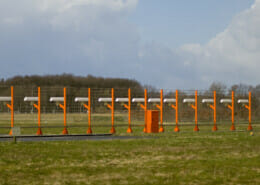
Radio Aids
Radio beacons, normally located on land, send out radio beams which tell us the aircraft’s range and direction from that radio aid. This allows the aircraft’s computer systems to calculate the aircraft’s location. The more radio signals that can be detect, the more accurate the estimated position is.
These radio aids are typically referred to as Very High Frequency Omni-Directional Radio Range (VOR) with associated Distance Measuring Equipment (DME). Others include a Non-Directional Beacon (NDB) bit this purely provides a pointer towards the beacon rather than any direct radial or distance information.
Instrument Landing Systems (ILS) are used to help guide the aircraft into land and this is covered in more detail on this page.
As you can see, if any one of these navigation systems fails, it’s not a problem as there is lots of redundancy onboard. Pilots don’t get lost very often!
Related Pages:
 ShutterStockWhat are the Different Layers of the Atmosphere?
 Shutter StockWhat is an ILS Approach?
 How Many Hours Can Pilots Fly A Day?
 Shutterstock.comPilot Licences Explained
 Advertise With Us
 Shutter StockUK University Aviation Degree Courses
 Interview a Pilot – For School Projects
 Shutter StockHow Long Does it Take to Become a Captain?