

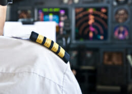
What can pilots see in cloud?
When flying within cloud and looking outside the front windows of the aircraft, the pilots can usually just see the same as the passengers, which isn’t very much! Instead they rely on their instruments to tell them where the aircraft is, where it is going and what’s around it. These instruments act as the pilot’s eyes when they can’t see anything.
Aircraft Instruments that Help the Pilots See in Cloud
The aircraft has a terrain map which is able to tell the pilots how high they are relative to the ground around it. This is particularly helpful when the plane is flying at a low altitude or flying within a mountainous area or with high ground around it. If pilots can’t see a high hill or mountain, they need to know where it is so they can avoid it.
The pilots also have a weather radar which can be viewed on their screens and this can help them determine what type of cloud it is they are flying through (or approaching), how much water there is in the cloud, and if there are more clouds behind it.
Another instrument which helps the pilots artificially see when in cloud is the Transponder and Traffic Collison Avoidance System (TCAS). These systems tell the pilots the position of other planes relative to their aircraft. Air Traffic Control (ATC) will also provide this information and will usually ensure adequate separation between aircraft, but the Transponder/TCAS system provides this information directly to the pilots for awareness. It will also direct the pilots away from another aircraft if the two planes get too close to each other.
What Instruments the Pilots Use When Flying in Cloud
There are plenty of other instruments which help the pilots determine where the plane is, what the plane is doing at any given time and where it is going. These include:
- Primary Flight Display (PDF) – This tells the pilots the aircraft’s trajectory relative to the three axis of roll, pitch and yaw. Simply put, it tells the pilots if the plane is flying straight, pointing up or down and/or turning left or right
- Airspeed Indicator – how fast the plane is flying and if it is accelerating and decelerating
- Altitude Indicator – how high the plane is flying and if it is climbing or descending
- Navigation Display – this indicates the exact position of the aircraft on a map and allows the terrain and clouds around the aircraft to be displayed relative to the aircraft position

Primary Flight Display (PFD)
Weather Radar
Airspeed Indicator
Altitude Indicator
Airbus PFD (left) and Weather Radar (right)
Avoiding Certain Cloud Types
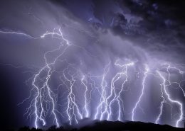
In some circumstances, the pilots may elect to avoid a cloud ahead of them because of the type of cloud it is. The pilots will be able to see if it is a thunderstorm type cloud (a cumulonimbus cloud) by looking at the amount of water content within in it on their weather radar. If there is significant quantities of water within the cloud, this can indicate there are strong up and down drafts which can induce severe turbulence, lightning and hail which is best avoided both for passenger comfort and flight safety.
A Separate Pilots Licence to Fly in Cloud
For a pilot to fly in cloud, they must have a special licence which permits them to do so; this is called an Instrument Rating (IR). To obtain an Instrument Rating, pilots must take a flying exam which demonstrates they are able to fly the aircraft solely by reference to their instruments without being able to see anything out the windows. All pilots flying for commercial airlines must hold an instrument rating to allow them to fly in cloud.
Generally speaking, the pilots are required to operate to separate rules when flying in weather conditions where visibility is reduced. These conditions are called ‘Instrument Meteorological Conditions’ (IMC) and the pilots are required to hold an instrument rating to flying within these conditions. When pilots have good visual reference with the ground, this is called Visual Meteorological Conditions (VMC) and they are permitted to navigate with reference to the ground and its various landmarks.


 ShutterStock